

Du følger nå
Feil med følging av bruker.
Denne brukeren tillater ikke brukere å følge dem.
Du følger allerede denne brukeren.
Medlemskapsplanen din tillater bare 0 følginger. Oppgrader her.
Sluttet å følge
Kunne ikke slutte å følge bruker.
Du har vellykket anbefalt
Kunne ikke anbefale bruker.
Noe gikk galt. Oppdater siden og prøv igjen.
Vellykket bekreftelse av e-post.

guelmim,
morocco
Det er for øyeblikket 6:35 p.m. her
Ble med mai 16, 2017
1
Anbefaling
Ayoub L.
@ayoubGis
4,2
4,2
100%
100%
guelmim,
morocco
100 %
Jobber fullført
100 %
Innenfor budsjett
100 %
I tide
20 %
Gjenansettelsesrate
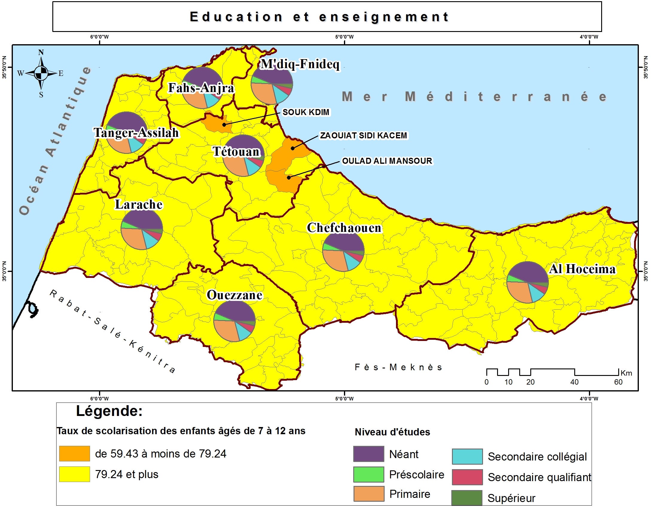
GIS, RS & Territorial Development
Kontakte Ayoub L. angående jobben din
Logg inn for å diskutere eventuelle detaljer over chat.
Portefølje
Portefølje

Spatial analysis

Spatial analysis
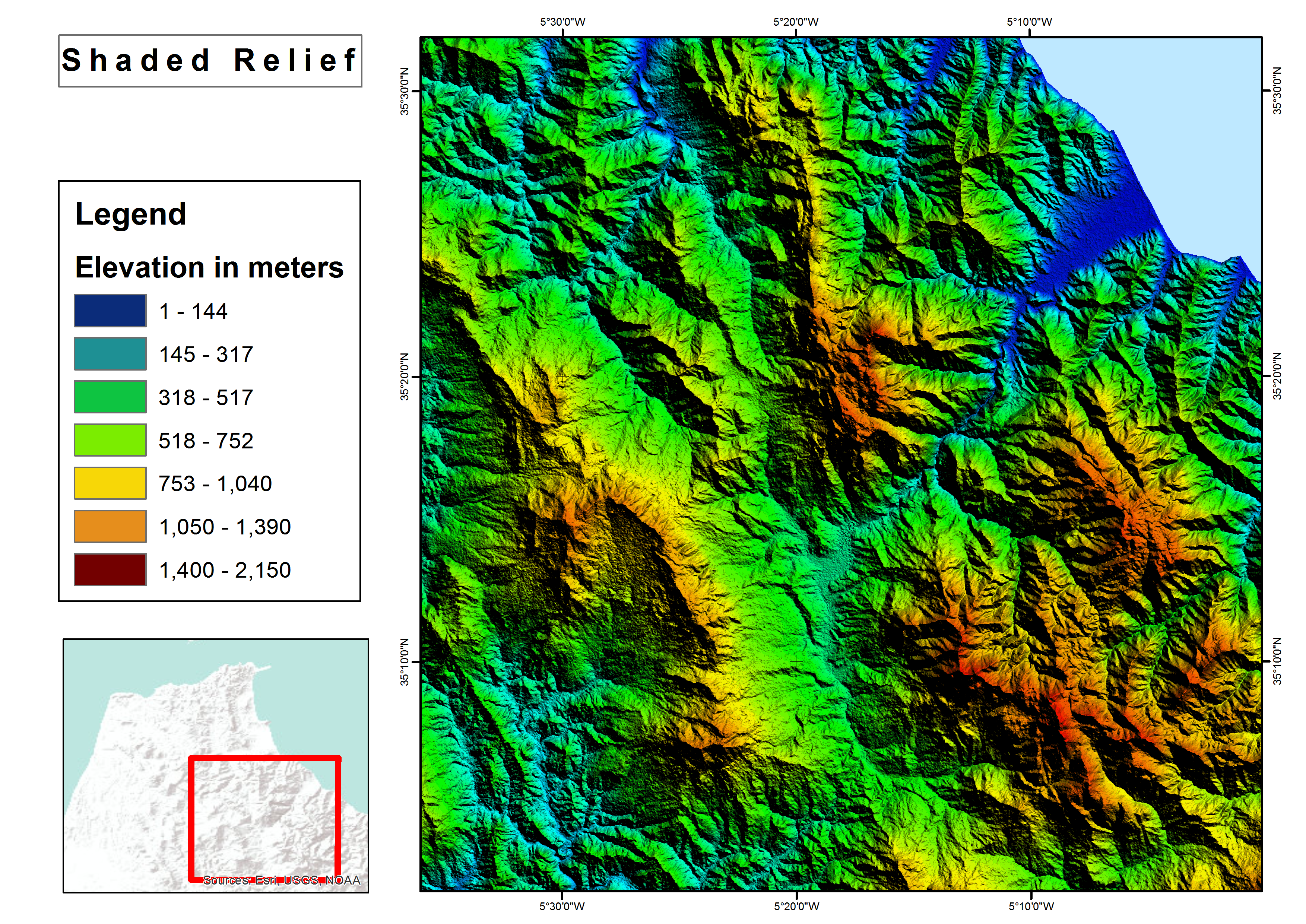

Shaded relief map
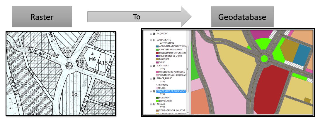

Raster to Geodatabase

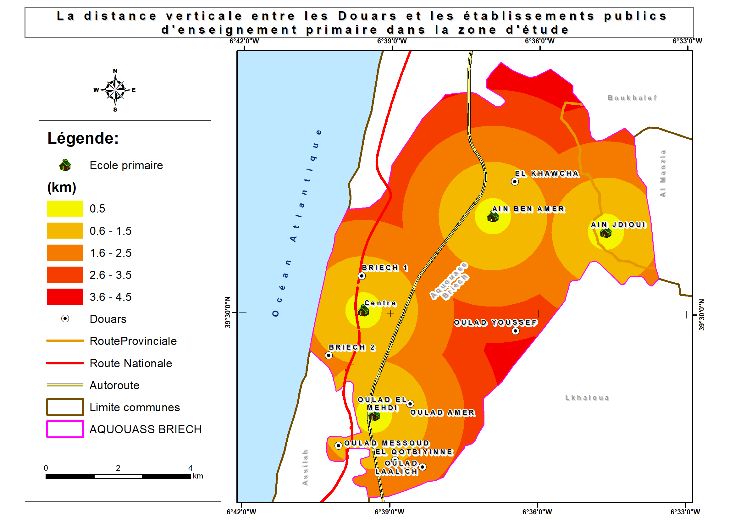
Thematic maps

Thematic maps

Thematic maps

Thematic maps

Brochure with Business Card

Brochure with Business Card
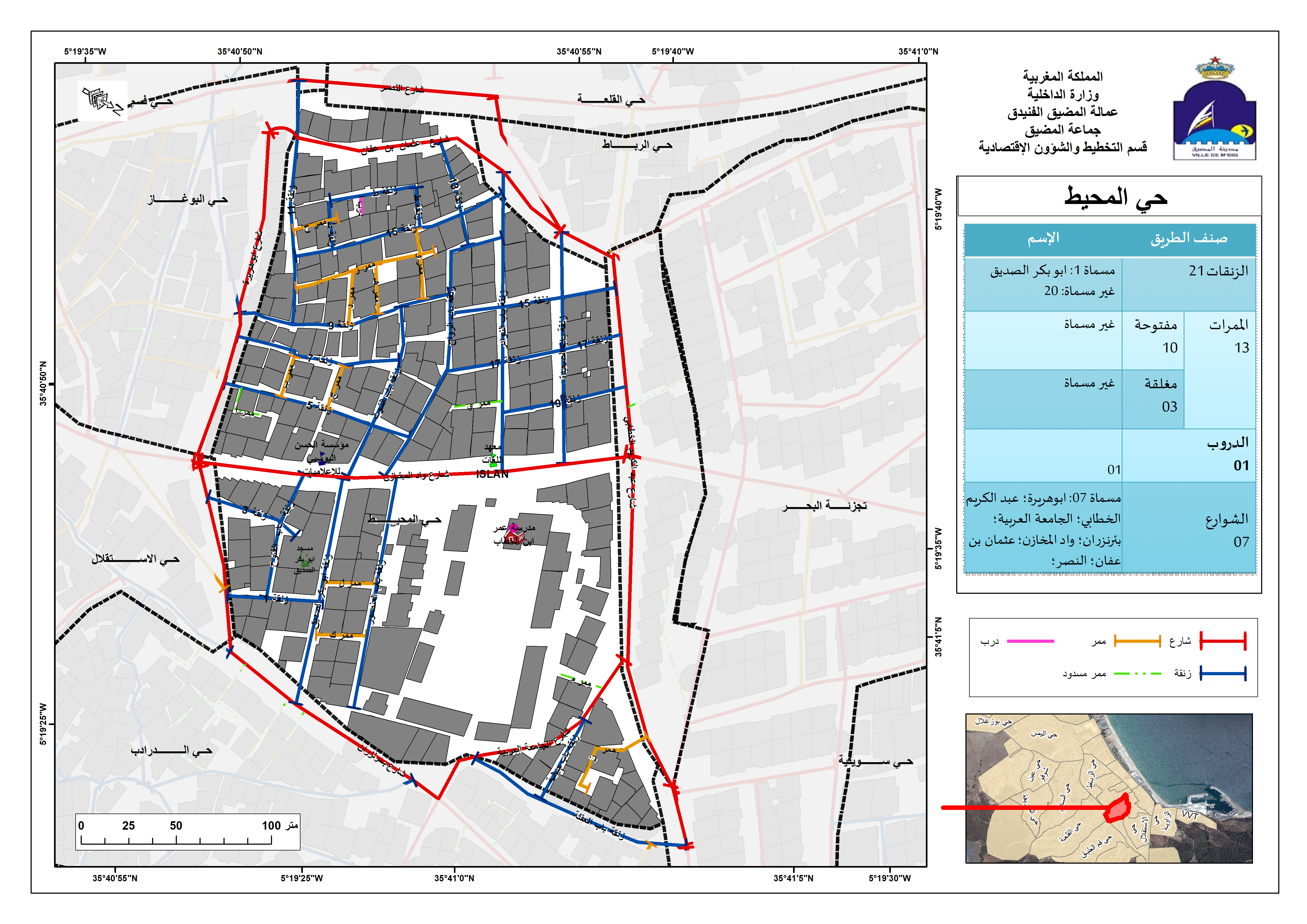

Street Addressing and Naming System
Spatial analysis
Spatial analysis
Shaded relief map
Raster to Geodatabase
Thematic maps
Thematic maps
Thematic maps
Thematic maps
Brochure with Business Card
Brochure with Business Card
Street Addressing and Naming System
Anmeldelser
Endringer lagret
Viser 1 - 5 av totalt 9 omtaler
$150,00 USD
Data Processing
Data Mining
Geospatial
JSON

•
€40,00 EUR
N

•
$10,00 USD
PHP
Data Processing
Data Entry
Excel
Web Scraping
A
•
€90,00 EUR
N
•
$50,00 USD
Logo Design
Illustrator
Prezi
Geospatial
+1 flere

•
Erfaring
GIS Specialist
jan. 2018 - Nå
• Performed geospatial analyses;
• shared interactive maps and services in ArcGIS Online;
• Collected and processed Landsat images for M’diq city;
• Used GIS technique (Desktop/Mobile) and Microsoft Access in business activities survey;
• Mapped a land use plan for M'diq-Fnideq prefecture beach;
• Designed billboards for Beach;
• Created Gis-based Street Addressing and Naming System;
• Mapped a Traffic Signs plan for M’diq city;
• Created compelling visual presentations.
Cartographer/GIS
jan. 2017 - jun. 2017 (5 måneder, 1 dag)
Designed land use plan using Geographical Information System.
GIS Intern
aug. 2016 - sep. 2016 (1 måned, 1 dag)
Created Geodatabase for Guelmim-Oued Noun Regional Roads.
Utdanning
Master's degree, Territorial Development and Spatial Governance
(3 år)
Bachelor's degree, Geography
(3 år)
Kontakte Ayoub L. angående jobben din
Logg inn for å diskutere eventuelle detaljer over chat.
Verifiseringer
Toppferdigheter
Bla i lignende frilansere
Bla i lignende utstillinger
Invitasjonen ble sendt!
Takk! Vi har sendt deg en lenke for at du skal kunne kreve din gratis kreditt.
Noe gikk galt. Vær så snill, prøv på nytt.
Kopiering til utklippstavlen mislyktes. Prøv igjen etter å ha justert tillatelsene dine.
Kopiert til utklippstavlen.
Forhåndsvisning innlasting
Tillatelse gitt for geolokalisering.
Påloggingsøkten din er utløpt og du har blitt logget ut. Logg på igjen.