

Du følger nå
Feil med følging av bruker.
Denne brukeren tillater ikke brukere å følge dem.
Du følger allerede denne brukeren.
Medlemskapsplanen din tillater bare 0 følginger. Oppgrader her.
Sluttet å følge
Kunne ikke slutte å følge bruker.
Du har vellykket anbefalt
Kunne ikke anbefale bruker.
Noe gikk galt. Oppdater siden og prøv igjen.
Vellykket bekreftelse av e-post.

bogor,
indonesia
Det er for øyeblikket 9:57 a.m. her
Ble med juli 26, 2009
0
Anbefalinger
Handy R.
@konservasi
1,5
1,5
100%
100%
bogor,
indonesia
100 %
Jobber fullført
100 %
Innenfor budsjett
100 %
I tide
N/A
Gjenansettelsesrate
I am an GIS Expert. I have been for 10 years
Kontakte Handy R. angående jobben din
Logg inn for å diskutere eventuelle detaljer over chat.
Portefølje
Portefølje

My customer
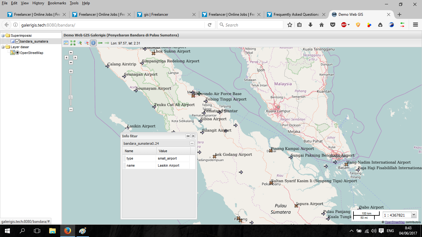

Airport map in Sumatera Island with Web GIS application
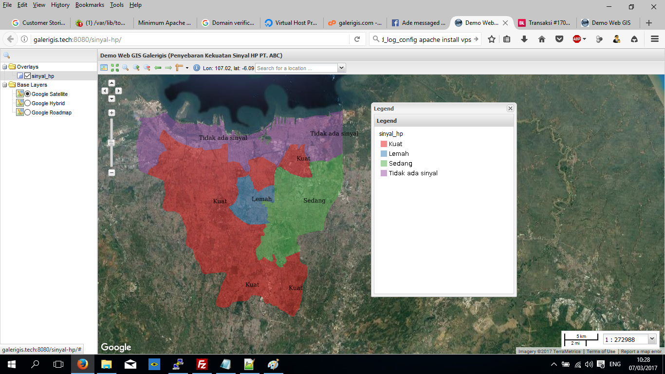

Strength provider mobile company (Web GIS application)
My customer
Airport map in Sumatera Island with Web GIS application
Strength provider mobile company (Web GIS application)
Anmeldelser
Endringer lagret
Viser 1 - 1 av totalt 1 omtaler
€10,00 EUR
Graphic Design
HTML
Illustrator
Photo Editing
Photoshop
N

•
Erfaring
Freelance
apr. 2010 - Nå
I have build my own business withthe website http://galreigis.com. From this year I have sell digital map but now I am focus in services of GIS. I also offer Web GIS worked
GIS Consultant
sep. 2007 - okt. 2009 (2 år, 1 måned)
I am responsibe to do GIS worked such as digitize a map. analysis of overlay the vector maps and count the area according the map. I also responsible to analyze raster image. I usually analyze landcover. I am using landsat and any other raster image
Utdanning
Bachelor Degree
(6 år)
Kontakte Handy R. angående jobben din
Logg inn for å diskutere eventuelle detaljer over chat.
Verifiseringer
Toppferdigheter
Bla i lignende frilansere
Bla i lignende utstillinger
Invitasjonen ble sendt!
Takk! Vi har sendt deg en lenke for at du skal kunne kreve din gratis kreditt.
Noe gikk galt. Vær så snill, prøv på nytt.
Kopiering til utklippstavlen mislyktes. Prøv igjen etter å ha justert tillatelsene dine.
Kopiert til utklippstavlen.
Forhåndsvisning innlasting
Tillatelse gitt for geolokalisering.
Påloggingsøkten din er utløpt og du har blitt logget ut. Logg på igjen.